RTK navigation (Real-Time Kinematic) is a high-precision positioning technique applied in order to reduce the errors of standard satellite navigation systems (GNSS; particularly GPS) from the order of a couple meters down to 1-2 centimeters. Modern RTK receivers even have multiple GNSS capabilities (namely, utilization of combinations of GPS, GLONASS (What is GLONASS?), Galileo (What is Galileo?) , and BeiDou along with multi-frequency support). This improves the performance as regards satellite availability, reliability and initialization time.
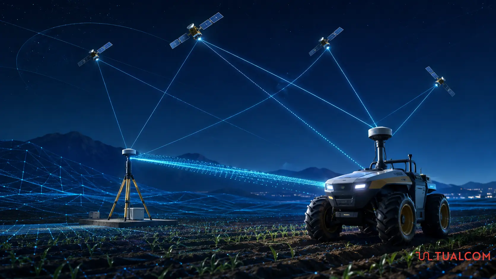
The operating principle of RTK is to utilize a device at an exactly known position; to measure the carrier phase of the satellite signal rather than just its information content; and to correct the atmospheric delays as well as clock errors at this device in real time.
How Does the RTK System Work?
An RTK system relies on two main hardware components:
- Base Station: This is nothing, but a reference receiver fixed at a location with a well-known (precisely pre-measured) coordinate. The base station compares its true position with the incoming satellite data and calculates the signal errors in a real-time manner. In summary, the base station re-broadcasts the phase of the carrier that it observes, and the mobile units (to be defined and referred as “rovers”) compare their own phase measurements with the one they receive from the base station. Since an RTK base station broadcasts continuously, it is also referred to as a Continuously Operating Reference Station (CORS).
- Rover Receiver (or simply “Rover”): This is the mobile receiver mounted on a vehicle, drone, tractor, or held by a surveyor. It receives direct signals from satellites; meanwhile simultaneously processes the correction data sent by the Base Station. The correction data is sent/received via either:
- Radio waves in RTCM (Radio Technical Commission for Maritime Services) format, or
- The Internet in NTRIP (Networked Transport of RTCM via Internet Protocol) format.
Differences Between RTK and Standard GNSS
The main differences between RTK and Standard GNSS can be summarized as follows:
| Feature | GNSS | RTK |
| Accuracy | Typically 3 – 10 meters | 1 – 2 centimeters |
| Hardware Required | Only a single receiver device | At least two receivers (Base + Rover) or a network connection |
| Cost | Low (Smartphones, smartwatches, etc.) | High (Industrial-grade equipment) |
Common Applications of RTK Navigation
RTK navigation find applications in sectors where even minor errors can lead to critical accidents:
- Autonomous Vehicles and Robotics: RTK can be integrated with other sensors (such as Cameras, LiDAR, IMU) at various platforms (such as self-driving vehicles, port logistics robots, and autonomous lawn mowers) in order to maintain safe positioning.
- Precision Agriculture: By means of RTK, tractors and autonomous farm machinery can plant crops along exact paths. This can prevent fertilization and spraying overlaps, which leads to yield increases.
- Drones and Aerial Surveying: With the help of RTK, it is possible to “geotag” the photos during photogrammetry and LiDAR flights with centimeter accuracy. This reduces the necessity of additional physical ground control points.
- Construction and Surveying: Thanks to RTK, complicated tasks such as:
- Boundary detection,
- Land registry surveying,
- Road construction,
- Excavation depth checks,
- Alignment of infrastructure with digital models
- etc.
becomes possible and feasible.