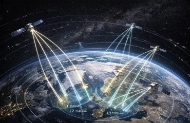
Standing for Positioning, Navigation and Timing; Assured PNT is an umbrella terminology used to describe any technology, service, device or system which is aimed to provide positioning, navigation and timing capabilities for various applications. Particularly:
- Positioning refers to the ability of determining the location and orientation (two-dimensional; or three-dimensional when required) of a target platform referenced to a standard geodetic system such as World Geodetic System 1984 (WGS84),
- Navigation is nothing but the ability of determining the relative or absolute position, applying corrections to speed, course and orientation to achieve a desired position/orientation,
- Timing is the capability of acquiring, maintaining and disseminating the time information (as regards a standard time frame such as Coordinated Universal Time, or UTC) in an accurate and precise manner.
PNT Services and Systems
A Global Navigation Satellite System (GNSS) is a system which relies on transmission of formatted signals from multiple satellites so that the receivers will be able to extract their own geopositioning solutions. GNSS is therefore one example—indeed the most classical example—of a PNT service. Global Positioning System (GPS) of the United States is the most well known GNSS system. Deployment of GPS satellites 1970s has provided almost ubiquitous opportunity to determine the position of a GPS receiver with a relatively good accuracy. Despite its military based origins, with the current technology and ever so cheap receivers, GPS is increasingly employed in many non-military equipment, such as mobile phones, to help with the needs of the general public.
While GNSS is, without a doubt, at the heart of almost all military and safety and mission-critical PNT applications, it has vulnerabilities that can impair its performance significantly. The vulnerabilities stem from the efforts to make it widely available, namely using satellite constellations, and can be listed as follows;
- GNSS signals have a very well-known frequency/modulation and structure and travel a long way before they reach the receiver rendering the signal become rather weak. This makes GNSS vulnerable to jamming and spoofing. In fact while spoofing a GPS signal requires a bit more elaborate effort, a GPS jammer can easily be purchased cheaply online .
- Since GNSS works on the time of arrival of signals from each satellite in the constellation, line of sight (LOS) becomes an issue. High mountains and especially high rise buildings in urban areas prevent LOS and reduce GNSS availability especially when satellites are at low elevation angles.
Such vulnerabilities cause a phenomenon called “GNSS degradation” which is not to be taken lightly as GNSS degradation seriously hinders PNT capabilities. This is probably why “PNT in GPS-denied environments” is identified as one of the top 12 (in terms of priority) research areas that should be emphasized in the near future.
On the other hand, GNSS is not the only service that supports positioning, navigation and precise timing. Other PNT sensors and services complementing the GNSS are:
- Satellite-based augmentation systems (SBAS),
- Ground-based augmentation systems (GBAS),
- Regional navigation systems, such as:
- Regional satellite navigation systems (e.g. NavIC of India; EGNOS of Europe); or
- Ground-based systems (e.g. Real-Time Kinematic (RTK) and Precise Point Positioning (PPP)), where Wi-Fi, cellular (3G, 4G and 5G) or custom (Ultra-Wide Band, etc.) reference signals are used to determine the location of the platform via techniques such as triangulation/multilateration,
- Inertial Measurement Units (IMUs), which are nothing but dead reckoning sensors, including gyroscopes, accelerometers and altimeters,
- Oscillators, which can provide precise time solution for a certain period,
- Cameras (of various sorts) and Light Detection and Ranging (LiDAR) devices, which enable correlation of reference data (such as the terrain data and/or labelled landmarks with known positions) as well as the data provided by other sensors in order to compute the position of the vehicle/platform.
Assured PNT
The integrity and accuracy of GNSS might sometimes be weakened due to various reasons such as atmospheric phenomena and environmental conditions, or disrupted by malicious energy attacks such as jamming and spoofing. That is where the concept of the so-called “Assured PNT (sometimes abbreviated as aPNT or A-PNT)” provide a solution while constituting a solid and rigid framework. The terminology refers to the combination of advanced PNT technologies in such a manner that relevant functionalities do not degrade even in the cases of combat-related and/or human-caused disruptions to GNSS.
Commercially thinking, A-PNT provides accurate and precise PNT functionalities under all circumstances, which is unarguably an added value for many applications in industry, transportation, agriculture, etc.
Considering the military applications, A-PNT enables accurate and precise:
- positioning of the combined forces,
- navigation of each unit/platform across the operational environment,
- synchronization management of the communication networks
yielding high level of situational awareness; effective protection, surveillance, targeting, and engagement at the battlefield. Moreover, by mitigating the impacts of GNSS-denial effects/attacks and allowing synchronized positioning, navigation, maneuvering capabilities, A-PNT supports multi- and cross-domain military activities at tactical, operational, and/or strategical levels.
Nevertheless, A-PNT is also a very solid requirement for almost all autonomous systems, regardless of their autonomy levels and intended uses. For autonomous driving, A-PNT provides sustainably accurate and precise PNT functionalities, which make it possible to guide the vehicle autonomously from one point to another using available routes and determine the best possible route using digital maps. For the autonomous aerial vehicles of different scales (such as UAVs and drones), A-PNT enables the performance of many tasks ranging from:
- security (e.g. border patrol, chemical/biological/radiological detection, anti-drug warfare, maritime vessel identification, etc.) to
- infrastructure surveillance (e.g. pipelines, power lines, railways, roads, airports, etc.) and
- mapping,
as well as:
- precision agriculture,
- forest and natural resource monitoring,
- firefighting and other disaster management,
- and many more
which require accurate and precise PNT information.
Assured PNT Services Provided by TUALCOM Products
Anti-Jam and Anti-Spoof TUALCOM Products
TUALCOM anti-jam product family are equipped with Controlled Reception Pattern Antennas (CRPAs), which quickly detect the direction(s) of the abnormal (due to jamming or spoofing) GNSS signal(s), apply digital beamforming techniques and nullify the reception in the relevant direction(s). This provides resilience against jamming and spoofing. Achievement of all these functionalities require a specialized domain knowledge as regards digital beam control and antenna array design and integration. In-house engineering capabilities of TUALCOM has enabled the development of a state-of-the-art Digital Antenna Control Unit (DACU) which utilizes the CRPA (easily configurable to 2-, 4- or 8-antenna systems) for mitigation against jamming and spoofing. Hence, each TUALCOM anti-jam product constitutes a very reliable A-PNT component, regardless of the application (military or commercial) and the integrated system status (either for a standard/legacy system; or for a customized system of a specific purpose). It shall also be emphasized that each relevant TUALCOM product complies with the natural and inevitable considerations of all users: size, weight, power and cost.
TUALCOM Terrestrial Navigation System: TRNAV
TUALCOM’s TRNAV is a regional terrestrial navigation system based on smart communication technologies. By setting up a network of TRNAV ground stations at already-known locations, any platform carrying a TUALCOM position finder will be able to compute and extract the position information available from the TRNAV system.
Based on similar operating principles of GNSS technology, TRNAV system has additionally been founded on the data link technology, which allows the capability of transferring not only the position information but also all other types of data (such as timing/synchronization data, video, sound, text, etc.). This is an unarguable added value for achievement of A-PNT. Extremely accurate and stable timing synchronization among the TRNAV network nodes enables calculation of precise position, which is comparable to the position precision of GNSS. Having the ability to operate independently (from of GNSS), TRNAV provides sustainable PNT functionalities under GNSS denied conditions. Moreover, the high computation rate of the system provides a more effective navigation opportunity compared to GNSS systems, especially for high-speed platforms.